
Flash Flood Warnings: What You Need to Know Before It’s Too Late
Have you ever received a flash flood warning and wondered how it was generated?
While such alerts may seem abrupt, they are the result of rigorous scientific processes and cutting-edge tools used by weather experts to save lives and protect property.
A flash flood is a sudden and rapid flood that occurs within minutes or hours of intense rainfall, a dam break, or overflowing water bodies. These events typically affect low-lying or poorly drained areas, and because they happen so quickly, they often catch communities off guard. A flash flood warning, therefore, is a critical, time-sensitive alert issued by meteorological authorities to inform the public that flash flooding is either already happening or expected imminently. It calls for immediate action, such as seeking higher ground and avoiding flooded roads.
To understand how these warnings are generated in Malawi, our staff reporter spoke with Alick Chibanthowa, a Weather and Climate Expert at the Department of Climate Change and Meteorological Services (DCCMS). He offered insight into the science, systems, and limitations that go into delivering life-saving warnings.

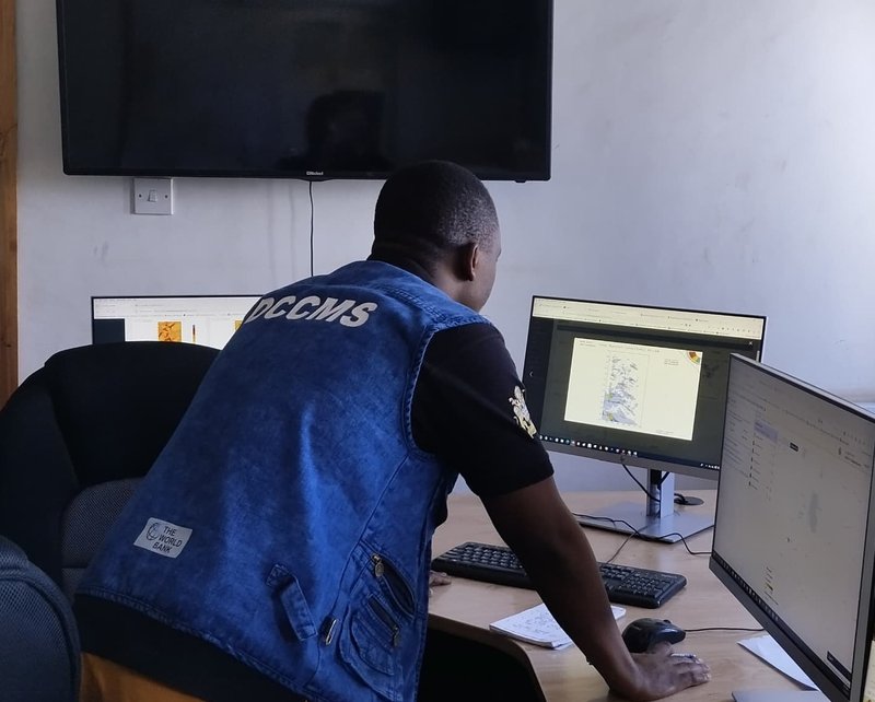
Alick Chibanthowa monitoring Flash Floods at DCCMS' HQs
How DCCMS Predicts Flash Floods
At DCCMS, a combination of methods is used to predict flash floods. These include:
Threshold Method: This involves setting a specific rainfall limit—called a threshold—for a given area within a set period (e.g., 24 hours). If the expected or observed rainfall meets or exceeds this level, it is likely to trigger flooding, prompting the issuance of a warning.
Numerical Weather Prediction (NWP): This method uses sophisticated computer models to simulate and forecast atmospheric conditions. By analysing weather and hydrological data, NWP models estimate rainfall amounts, runoff levels, and flood potential.
Analog Method: This approach compares current weather patterns with those from past flood events. If present conditions resemble previous flooding scenarios, forecasters can estimate the likelihood of flash flooding based on historical outcomes.
Flood Frequency Analysis: This statistical method assesses long-term flood data to estimate the probability of future flood events. For instance, a "100-year flood" has a 1% chance of occurring in any given year. It’s a valuable tool for planning and risk assessment.
Tools Behind the Forecast
DCCMS also utilises several advanced tools to support flood forecasting:
Flash Flood Guidance System (FFGS): Integrates satellite rainfall estimates, ground observations, and hydrological models to generate real-time flash flood risk maps.
COSMO (Consortium for Small-scale Modelling): Provides high-resolution climate modelling for improved flash flood prediction.
Operational Decision Support System (ODSS): Specifically tailored to monitor and predict floods in the Shire River Basin (Chikwawa and Nsanje).
Impact-Based Forecasting Portal (IBF): Focuses on predicting floods in areas like Blantyre, Karonga, and Rumphi, combining weather data with social and economic vulnerability indicators.
Chibanthowa crafting a flash flood warning in the nick of time
Challenges and Limitations
Despite these advancements, Chibanthowa acknowledges some limitations in both methods and tools:
Many forecasting tools rely on stable electricity and internet access—a challenge in some areas of Malawi. Some systems, like ODSS and IBF, are costly to run and maintain, depending on external funding and donor support. The atmosphere is naturally chaotic, and even the best tools can sometimes provide inaccurate forecasts due to the complexity of weather systems.
Similarly, the forecasting methods themselves have hurdles:
NWP models need a steady internet connection and reliable data feeds. Flood Frequency Analysis is time-consuming and requires decades of quality historical data. In areas with limited observations or weak historical records, forecasting becomes less accurate.
Why It Matters
So, the next time you receive a flash flood warning, you’ll know it’s not just guesswork—it’s the result of extensive analysis, technology, and expert judgment. These warnings are designed to give you time to act and stay safe. As climate change continues to influence weather patterns, the role of timely and reliable forecasts has never been more important. And behind every warning is a team working tirelessly to turn data into decisions that save lives.